


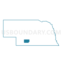
Stockville Precinct, Frontier County, Nebraska
About
Outline

Summary
| Unique Area Identifier | 613140 |
| Name | Stockville Precinct |
| County | Frontier County |
| State | Nebraska |
| Area (square miles) | 420.10 |
| Land Area (square miles) | 417.21 |
| Water Area (square miles) | 2.89 |
| % of Land Area | 99.31 |
| % of Water Area | 0.69 |
| Latitude of the Internal Point | 40.50394930 |
| Longtitude of the Internal Point | -100.31480070 |
Maps


Graphs
Select a template below for downloading or customizing gragh for Stockville Precinct, Frontier County, Nebraska


Neighbors
Neighoring Voting District (by Name) Neighboring Voting District on the Map
- Bartley Precinct, Red Willow County, NE
- Brady Precinct, Lincoln County, NE
- Cambridge Precinct, Furnas County, NE
- Curtis Precinct, Frontier County, NE
- Eustis Precinct, Frontier County, NE
- Farnam Precinct, Dawson County, NE
- Garden Prairie Precinct, Frontier County, NE
- Indianola Precinct, Red Willow County, NE
- Precinct 4, Gosper County, NE
- Willow Precinct, Red Willow County, NE
Top 10 Neighboring County Subdivision (by Population) Neighboring County Subdivision on the Map
- Cambridge precinct, Furnas County, NE (1,270)
- Brady precinct, Lincoln County, NE (1,094)
- Farnam precinct, Dawson County, NE (216)
- Curtis precinct, Frontier County, NE (112)
- Moorefield precinct, Frontier County, NE (96)
- North Valley precinct, Red Willow County, NE (81)
- Allen precinct, Frontier County, NE (79)
- Fritsch precinct, Red Willow County, NE (72)
- Garfield precinct, Frontier County, NE (66)
- Alliance precinct, Red Willow County, NE (44)
Top 10 Neighboring Place (by Population) Neighboring Place on the Map
Top 10 Neighboring Unified School District (by Population) Neighboring Unified School District on the Map
- McCook Public Schools, NE (9,174)
- Southwest Public Schools, NE (2,093)
- Arapahoe Public Schools, NE (1,905)
- Elwood Public Schools, NE (1,828)
- Cambridge Public Schools, NE (1,550)
- Medicine Valley Public Schools, NE (1,356)
- Eustis-Farnam Public Schools, NE (1,066)
- Maywood Public Schools, NE (871)
Top 10 Neighboring State Legislative District Upper Chamber (by Population) Neighboring State Legislative District Upper Chamber on the Map
- State Senate District 42, NE (36,288)
- State Senate District 44, NE (33,011)
- State Senate District 38, NE (32,734)
Top 10 Neighboring 111th Congressional District (by Population) Neighboring 111th Congressional District on the Map
Top 10 Neighboring Census Tract (by Population) Neighboring Census Tract on the Map
- Census Tract 9639, Furnas County, NE (4,959)
- Census Tract 9597, Lincoln County, NE (3,669)
- Census Tract 9611, Frontier County, NE (2,756)
- Census Tract 9631, Red Willow County, NE (2,708)
- Census Tract 9676, Gosper County, NE (2,044)
- Census Tract 9686, Dawson County, NE (1,573)
Top 10 Neighboring 5-Digit ZIP Code Tabulation Area (by Population) Neighboring 5-Digit ZIP Code Tabulation Area on the Map
- 69001, NE (9,449)
- 69022, NE (1,570)
- 69025, NE (1,220)
- 69034, NE (908)
- 69028, NE (731)
- 69020, NE (397)
- 68948, NE (363)
- 69029, NE (316)
- 69039, NE (139)
- 69042, NE (36)